Sedona weatherWhat’s on in Sedona →
Petrified Forest National Park

Get out of town

Day trips from Sedona

14 nearby parks, towns and places to explore, ordered by straight-line distance.

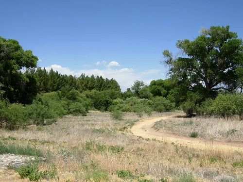
Dead Horse Ranch State ParkState park

Dead Horse Ranch State Park

16 miles southwest · straight-line distance

Protected area in Yavapai County, Arizona.

Confirm the visitor entrance, hours, reservations, access and seasonal conditions. Islands or water destinations may require different transport.
Tuzigoot National MonumentNational park site

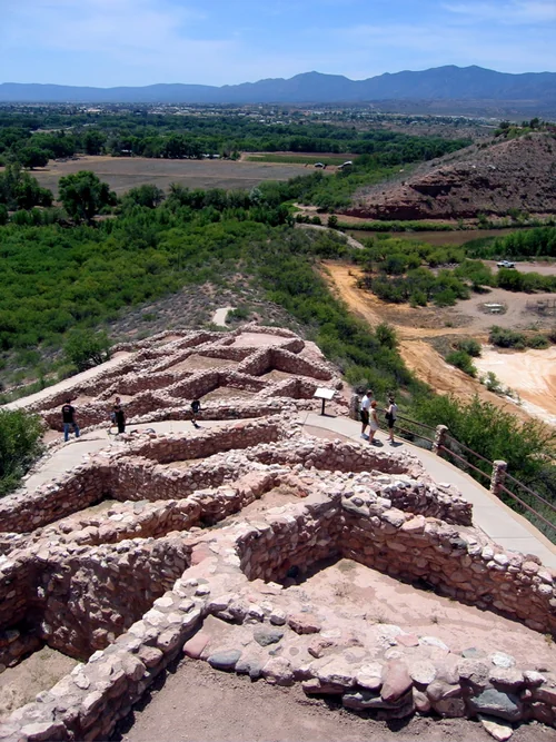
Tuzigoot National Monument

17 miles southwest · straight-line distance

National monument in Yavapai County, Arizona.

Wildlife viewingAgency site ↗

Confirm the visitor entrance, hours, reservations, access and seasonal conditions. Islands or water destinations may require different transport.
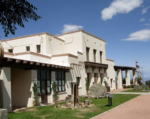
Montezuma Castle National MonumentNational park site

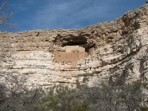
Montezuma Castle National Monument

18 miles south · straight-line distance

Archaeological site in the United States.

PicnickingWildlife viewingAgency site ↗

Confirm the visitor entrance, hours, reservations, access and seasonal conditions. Islands or water destinations may require different transport.
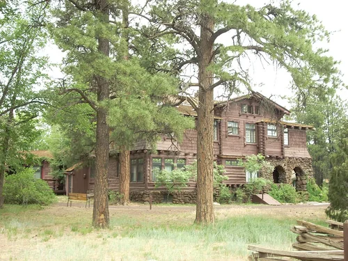
Jerome State Historic ParkState park

Jerome State Historic Park

21 miles west · straight-line distance

State park.

Confirm the visitor entrance, hours, reservations, access and seasonal conditions. Islands or water destinations may require different transport.
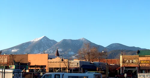
Riordan Mansion State Historic ParkState park

Riordan Mansion State Historic Park

23 miles north · straight-line distance

Protected area in Flagstaff, Arizona, US.

Confirm the visitor entrance, hours, reservations, access and seasonal conditions. Islands or water destinations may require different transport.
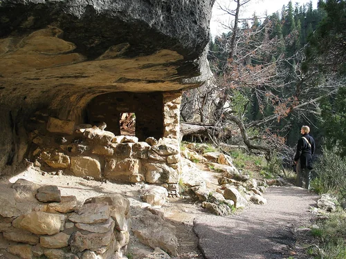
FlagstaffTown

Flagstaff

24 miles north · straight-line distanceAbout 50 min by car (33 road miles, typical traffic, checked October 2026)

City in and county seat of Coconino County, Arizona, United States.

Confirm the visitor entrance, hours, reservations, access and seasonal conditions. Islands or water destinations may require different transport.
Walnut Canyon National MonumentNational park site

Walnut Canyon National Monument

25 miles northeast · straight-line distance

United States National Monument in Arizona.

Confirm the visitor entrance, hours, reservations, access and seasonal conditions. Islands or water destinations may require different transport.
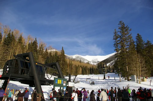
Arizona SnowbowlSki area

Arizona Snowbowl

32 miles north · straight-line distanceSaved road-route estimate: 44 miles · 1 hr 30 min

An alpine ski resort located on the San Francisco Peaks.

Confirm the visitor entrance, hours, reservations, access and seasonal conditions. Islands or water destinations may require different transport.
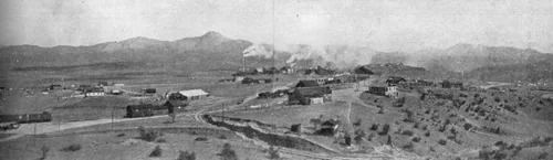
Dewey–HumboldtTown

Dewey–Humboldt

36 miles southwest · straight-line distanceAbout 1 hr by car (52 road miles, typical traffic, checked October 2026)

Town in Yavapai County, Arizona.

Confirm the visitor entrance, hours, reservations, access and seasonal conditions. Islands or water destinations may require different transport.
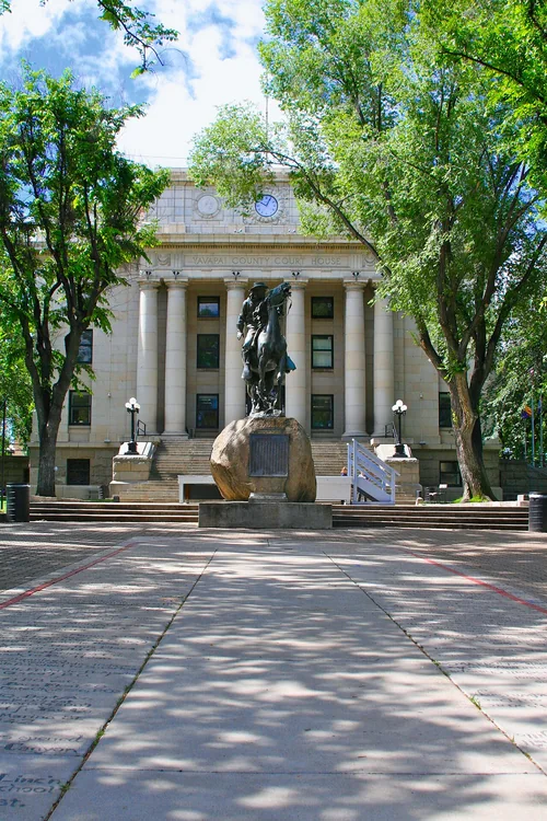
Town

Williams

36 miles northwest · straight-line distanceAbout 1 hr 10 min by car (61 road miles, typical traffic, checked October 2026)

City in Coconino County, Arizona, United States.

Confirm the visitor entrance, hours, reservations, access and seasonal conditions. Islands or water destinations may require different transport.
PrescottTown

Prescott

46 miles southwest · straight-line distanceAbout 1 hr 15 min by car (67 road miles, typical traffic, checked October 2026)

City in and county seat of Yavapai County, Arizona, United States.

Confirm the visitor entrance, hours, reservations, access and seasonal conditions. Islands or water destinations may require different transport.

Town

Payson

50 miles southeast · straight-line distanceAbout 1 hr 40 min by car (86 road miles, typical traffic, checked October 2026)

Town in Gila County, Arizona, United States.

Confirm the visitor entrance, hours, reservations, access and seasonal conditions. Islands or water destinations may require different transport.

Arizona Museum of Natural HistoryThings to do

Arizona Museum of Natural History

101 miles south · straight-line distanceAbout 2 hr 5 min by car (131 road miles, typical traffic, checked October 2026)

History museum.

Confirm the visitor entrance, hours, reservations, access and seasonal conditions. Islands or water destinations may require different transport.

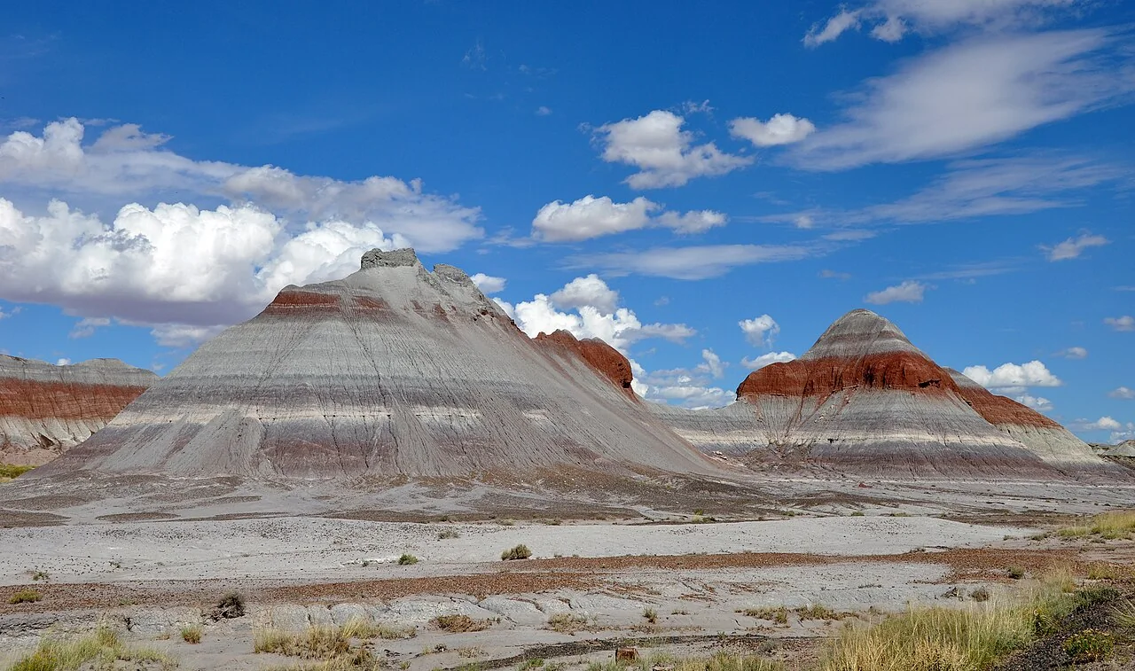
Petrified Forest National ParkNational park site

Petrified Forest National Park

112 miles east · straight-line distance

National park of the United States.

Confirm the visitor entrance, hours, reservations, access and seasonal conditions. Islands or water destinations may require different transport.

Driving times are typical estimates from the city center without live traffic, Powered by Geoapify · © OpenStreetMap contributors.

Distances are straight-line measurements from the city, not driving distance. Saved road estimates have no consistently recorded source date and are not current traffic; estimates to park centers, water locations or inconsistent routes are omitted. Named-destination route links are not verified entrances. Place descriptions come from Wikidata; photo credits below include recorded capture dates when available. A photograph does not show current conditions.

Outdoor places near Sedona

40 recreation areas and campgrounds within 114 miles, from Recreation.gov. Filter by what you want to do.

Campground

Chavez Crossing

2 miles southwest · straight-line distanceAbout 5 min by car (3 road miles, checked October 2026)USDA Forest Service

Chavez Crossing Group Campground is in the picturesque Red Rock district of Arizona, with famous red rock formations and breathtaking painted sunsets.

Camping

Campground

Crescent Moon Ramada

4 miles southwest · straight-line distanceAbout 15 min by car (7 road miles, checked October 2026)USDA Forest Service

Crescent Moon sits beneath the stunning Cathedral Rock, one of the most photographed scenes in the American Southwest.

BikingCampingFishingHikingPhotographyPicnickingSwimming

Campground

Crescent Moon Ranch Cabin

4 miles southwest · straight-line distanceAbout 15 min by car (8 road miles, checked October 2026)USDA Forest Service

Crescent Moon Ranch is an exceptional year-round place to stay in beautiful Sedona.

BikingCampingFishingHikingHuntingSwimmingWildlife viewing

Campground

Manzanita.

5 miles north · straight-line distanceUSDA Forest Service

Manzanita Campground is a small, year-round, tent-only facility with campsites that fill up very quickly. Visitors enjoy the campground for its fishing and swimming holes along Oak Creek, beautiful scenery and excellent wildlife watching.

CampingFishingSwimming

Campground

Cave Spring

9 miles north · straight-line distanceAbout 20 min by car (12 road miles, checked October 2026)USDA Forest Service

Cave Springs sits in the scenic Oak Creek Canyon and is one of Coconino National Forest's most popular campgrounds. The campground is nestled in a forested canyon near the town of Sedona, Arizona, and its famous red rock cliffs.

BirdingCampingFishingHikingPhotographySwimmingWildlife viewing

Campground

Pine Flat Campground West

10 miles north · straight-line distanceAbout 20 min by car (13 road miles, checked October 2026)USDA Forest Service

Pine Flat Campground is a popular camping spot in scenic Oak Creek Canyon in Arizona's Coconino National Forest. The campground is nestled in a forested canyon near the well-known town of Sedona, Arizona, and its red rock cliffs.

CampingFishingHikingPhotographyStar GazingSwimmingWildlife viewing

Campground

Fernow Cabin

11 miles northwest · straight-line distanceAbout 1 hr 55 min by car (34 road miles, checked October 2026)USDA Forest Service

Fernow Cabin offers a quaint, forested retreat near Flagstaff and Sedona, in central Arizona. The rustic, three-bedroom log cabin is a retired U.S.

BikingCampingHikingHuntingWildlife viewing

Campground

Double Springs

16 miles east · straight-line distanceAbout 1 hr 15 min by car (52 road miles, checked October 2026)USDA Forest Service

Double Springs Campground is an “old fashion” campground, originally built in the 1930’s, and has sites nestled in a beautiful draw filled with cool grass, ponderosa pine and Gambel oak.

Camping

Campground

Apache Maid Cabin

17 miles southeast · straight-line distanceAbout 1 hr 10 min by car (34 road miles, checked October 2026)USDA Forest Service

This rustic forest cabin is located at the eastern base of Apache Maid Mountain, just two hours north of Phoenix and near the popular red rock canyons and outdoor recreation opportunities of Sedona, in central Arizona.

BikingCampingFire Lookouts/Cabins OvernightFishingHikingHistoryHuntingWildlife viewing

Campground

Dairy Springs

17 miles east · straight-line distanceAbout 1 hr 15 min by car (51 road miles, checked October 2026)USDA Forest Service

Dairy Springs is a comfortable campground tucked away in a scenic area of northern Arizona. Its main attraction is the seasonal Mormon Lake which, when filled with water, draws visitors for fishing, windsurfing and wildlife watching.

BikingCampingFishingHikingHorseback ridingPicnickingWildlife viewing

Recreation area

Montezuma Castle National Monument

17 miles south · straight-line distanceNational Park Service

Established December 8, 1906, Montezuma Castle is the third National Monument dedicated to preserving Native American culture.

PicnickingWildlife viewing

Recreation area

Tuzigoot National Monument

17 miles southwest · straight-line distanceNational Park Service

Water flows under and through this landscape, feeding the growth of people and towns. The Verde Valley is watered by snowmelt, summer monsoons, and springs that well up from the ancient sedimentary rocks.

Wildlife viewing

Campground

Pinegrove

20 miles northeast · straight-line distanceAbout 1 hr 5 min by car (45 road miles, checked October 2026)USDA Forest Service

Pinegrove Campground sits in the lush Coconino National Forest of northern Arizona, offering visitors countless recreation opportunities set in a stunning landscape.

BikingBoatingCampingFishingHikingWildlife viewing

Campground

WHITE HORSE LAKE Campground

22 miles northwest · straight-line distanceAbout 2 hr by car (66 road miles, checked October 2026)USDA Forest Service

White Horse Lake is an extremely popular fishing lake, 19 miles southeast of Williams, in northern Arizona.

BikingBoatingCampingFishingHikingKayakingPicnickingRanger programs

Campground

Clear Creek Campground (AZ)

24 miles south · straight-line distanceAbout 45 min by car (36 road miles, checked October 2026)USDA Forest Service

This cozy group campground is tucked in the Lower Sonoran Desert along the banks of the fresh, chilly Clear Creek. Campers can wade in the creek, fish, or curl up with a book under the umbrella of cottonwood trees.

BirdingCamping

Campground

Mingus Mountain Campground and Group Site

24 miles southwest · straight-line distanceAbout 1 hr 5 min by car (38 road miles, checked October 2026)USDA Forest Service

Looking for a perfect getaway to immerse yourself in nature? Look no further than the Mingus Mountain Campground!

CampingStar GazingWildlife viewing

Campground

Playground Group

24 miles southwest · straight-line distanceAbout 1 hr by car (37 road miles, checked October 2026)USDA Forest Service

Close to historic western towns and centrally located in Arizona, Playground Group Campground is a great place for groups of up to 75 people to enjoy a secluded mountain getaway. The 7,500 ft.

CampingPicnicking

Campground

Potato Patch Campground

25 miles southwest · straight-line distanceAbout 55 min by car (36 road miles, checked October 2026)USDA Forest Service

Campers looking for some peace and quiet will find this relaxing campground offers cool summertime temperatures and easy access from scenic Hwy 89A in central Arizona. The campground is located at 7,200 ft.

CampingWildlife viewing

Recreation area

Coconino National Forest Recreation

29 miles northeast · straight-line distanceUSDA Forest Service

BikingBoatingCampingClimbingFire Lookouts/Cabins OvernightFishingHikingHorse Camping

Recreation area

Prescott National Forest

33 miles southwest · straight-line distanceUSDA Forest Service

.

BoatingCampingFire Lookouts/Cabins OvernightHikingHorse CampingHorseback ridingPicnickingWildlife viewing

Recreation area

Kaibab National Forest

35 miles northwest · straight-line distanceUSDA Forest Service

BikingBoatingCampingFire Lookouts/Cabins OvernightFishingHikingHorse CampingHorseback riding

Recreation area

Agua Fria National Monument

48 miles southwest · straight-line distanceBureau of Land Management

Plan Your Visit Visitors to Agua Fria National Monument can hike in rugged landscapes, view rock art, and experience wide‑open desert vistas with few built facilities.

BikingBirdingDispersed CampingHikingHistoryHorseback ridingOff-highway vehiclesPhotography

Recreation area

Wupatki National Monument

52 miles northeast · straight-line distanceNational Park Service

Nestled between the Painted Desert and ponderosa highlands of northern Arizona, Wupatki National Monument is an unlikely landscape for a thriving community.

HikingWildlife viewing

Recreation area

Tonto National Forest

67 miles south · straight-line distanceUSDA Forest Service

BikingBoatingCampingClimbingFishingHikingHorse CampingHorseback riding

Recreation area

Hassayampa River Canyon Wilderness

71 miles southwest · straight-line distanceBureau of Land Management

The 11,840-acre Hassayampa River Canyon Wilderness Area is about eight miles northeast of Wickenburg. It is 48 miles northwest of Phoenix, Arizona, in Yavapai County.

BackpackingHikingHorseback ridingPhotographyWilderness

Recreation area

Black Canyon National Recreation Trail

72 miles south · straight-line distanceBureau of Land Management

The 80-mile Black Canyon Trail provides visitors with a long-range backcountry trail riding, mountain biking, and hiking opportunity.

Accessible Facility Or ActivityCampingHikingHorseback ridingMountain BikingPicnickingWildlife viewing

Recreation area

Hell's Canyon Wilderness

72 miles southwest · straight-line distanceBureau of Land Management

The 9,951-acre Hells Canyon Wilderness Area is a portion of the Hieroglyphic Mountains. The most prominent peaks are Garfias Mountain at 3,381 feet (1,030.5 m) and Hellgate Mountain at 3,339 feet (1,017.7 m).

BackpackingClimbingDispersed CampingRock ClimbingWildernessWildlife viewing

Recreation area

Lake Pleasant

77 miles southwest · straight-line distanceBureau of Reclamation

This newly expanded reservoir has 114 miles of shoreline for family recreation uses. The reservoir boasts a 10-lane boat ramp; parking for 200 vehicles. Recreational facilities concentrated primarily on the reservoir's western shore.

BikingBoatingCampingFishingHikingHistoryOff-highway vehiclesPicnicking

Recreation area

Grand Canyon National Park

81 miles north · straight-line distanceNational Park Service

Entirely within the state of Arizona, the park encompasses 278 miles (447 km) of the Colorado River and adjacent uplands.

BikingBoatingCampingFishingHikingHistoryHorse CampingPaddling

Recreation area

WestWorld

86 miles south · straight-line distanceBureau of Reclamation

WestWorld is located in north Scottsdale at the base of the McDowell Mountains. Surrounded by the Sonoran Desert with over 360 acres of pristine landscaping, the covered Equidome Arena, Brett's Barn, and state-of-the-art equine facilities…

HikingHorseback ridingPicnickingRecreational Vehicles

Recreation area

Upper Burro Creek Wilderness

88 miles west · straight-line distanceBureau of Land Management

The 27,440-acre Upper Burro Creek Wilderness is located in Yavapai and Mohave counties in Arizona, 60 miles west of Prescott and 60 miles southeast of Kingman.

Bird WatchingBirdingDispersed CampingHikingPhotographySwimmingWildernessWildlife viewing

Recreation area

Tonto National Monument

92 miles southeast · straight-line distanceNational Park Service

Located within the northern range of the Sonoran Desert lie two cliff dwellings that were occupied from 1300-1450 CE (common era). They represent a vibrant culture consisting of local and immigrant groups that lived in the Tonto Basin.

HikingPicnicking

Recreation area

Tres Alamos Wilderness

92 miles southwest · straight-line distanceBureau of Land Management

The 8,300-acre Tres Alamos Wilderness Area is in Yavapai County, 80 miles northwest of Phoenix, Arizona, and six miles south of the Santa Maria River.

BackpackingCampingHikingHorseback ridingPhotographyWildernessWildlife viewing

Recreation area

Burro Creek Recreation Site

99 miles west · straight-line distanceBureau of Land Management

The Burro Creek Recreation Site is situated along Burro Creek within a very scenic Sonoran Desert canyon at an elevation of 1,960 feet. This peaceful area has long been a favorite stop of travelers on nearby Highway 93.

BackpackingBird WatchingBirdingCampingCamping AreaHikingPhotographyWater Access

Recreation area

Arrastra Mountain Wilderness

100 miles west · straight-line distanceBureau of Land Management

The 129,800-acre Arrastra Mountain Wilderness is located in Mohave, Yavapai, and La Paz counties, 100 miles northwest of Phoenix and 70 miles southeast of Kingman, Arizona.

BackpackingHikingWilderness

Recreation area

Hummingbird Springs Wilderness

112 miles southwest · straight-line distanceBureau of Land Management

The 31,200-acre Hummingbird Springs Wilderness lies 55 miles west of Phoenix in western Maricopa County.

HikingWilderness

Recreation area

Petrified Forest National Park

112 miles east · straight-line distanceNational Park Service

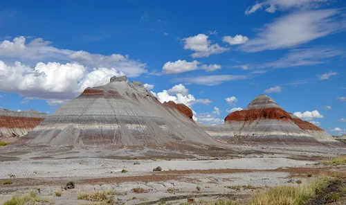
A landscape where deep time lies fully on display, Petrified Forest National Park blends colorful badlands, vast grasslands, and one of the world’s largest and most vivid collections of petrified wood.

BikingCampingHikingHistoryHorse CampingHorseback ridingPicnickingWildlife viewing

Recreation area

Harcuvar Mountains Wilderness

113 miles southwest · straight-line distanceBureau of Land Management

The 25,050-acre Harcuvar Mountains Wilderness in Arizona is managed by the Bureau of Land Management.

BackpackingClimbingHikingHorseback ridingHuntingWildernessWildlife viewing

Recreation area

Harquahala Mountains Wilderness

113 miles southwest · straight-line distanceBureau of Land Management

The 22,880-acre Harquahala Mountains Wilderness lies in Maricopa and La Paz counties, 80 miles northwest of Phoenix, Arizona. This wilderness contains part of one of western Arizona's largest desert mountain ranges.

BackpackingBird WatchingBirdingDispersed CampingHikingHorseback ridingWildernessWildlife viewing

Recreation area

Alamo Lake

114 miles southwest · straight-line distanceUS Army Corps of Engineers

This Corps lake is managed by Arizona State Parks. The project web address links to the Arizona State Parks web pages. Alamo Lake is one of the best bass lakes in Arizona. Also, the area has good wildlife viewing opportunities.

BoatingCampingFishingHikingPicnickingWater sportsWildlife viewing

Recreation areas and campgrounds from Recreation.gov's directory, checked October 9, 2026. Listings are not live availability: check Recreation.gov or the managing agency for open dates, fees, reservations and conditions. Directions go to the listed coordinates, which may not be the entrance. Campground driving times: Powered by Geoapify · © OpenStreetMap contributors.

Questions

What day-trip ideas are near Sedona?

This guide includes Dead Horse Ranch State Park, Tuzigoot National Monument, Montezuma Castle National Monument, Jerome State Historic Park, Riordan Mansion State Historic Park. Places are ordered by straight-line distance. Confirm visitor access, opening hours and current travel conditions before choosing a trip.

How far is Dead Horse Ranch State Park from Sedona?

Approximately 16 miles southwest in a straight line. This is not current traffic or a route to a verified visitor entrance. Use the named destination and confirm the appropriate entrance or transport.

How far is Tuzigoot National Monument from Sedona?

Approximately 17 miles southwest in a straight line. This is not current traffic or a route to a verified visitor entrance. Use the named destination and confirm the appropriate entrance or transport.

How far is Montezuma Castle National Monument from Sedona?

Approximately 18 miles south in a straight line. This is not current traffic or a route to a verified visitor entrance. Use the named destination and confirm the appropriate entrance or transport.

Where can I camp near Sedona?

Recreation.gov lists 16 campgrounds within 25 miles, including Chavez Crossing (2 miles southwest), Crescent Moon Ramada (4 miles southwest), Crescent Moon Ranch Cabin (4 miles southwest). Check Recreation.gov for current availability, seasons and reservations.

Sedona AI

Your Sedona local guide
Hey there!

I'm Sedona AI. Ask about neighborhood food, independent shops, local history or planning a visit.

AI recommendations may be inaccurate. Verify hours and prices. Questions are processed by Cloudflare. Privacy